About Us
Who we are & What is the purpose of the platform.
The GMES & Africa – North Africa
The GMES& Africa - North Africa is a consortium set up by the Sahara and Sahel Observatory (OSS) with the support of the prime national and regional institutions and partners in charge of the development and valorisation of Earth Observation products in support of the sustainable management of land and water resources in the North African region.
The consortium is implementing a regional project on « Earth Observation for Sustainable Management of Land and Water in North Africa » since July 2018. This project is part of the GMES & Africa global initiative funded by the European Commission through the African Union Commission covering the entire African continent.
Consortium leader
Sahara and Sahel Observatory (OSS)
National Partners
- Professionals, managers and experts agriculture in environment and water resources management in the North African region and beyond.
- Algerian Space Agency (ASAL), based in Algiers (Algeria).
- National Center for Cartography and Remote Sensing (CNCT), based in Tunis (Tunisia).
- Desert Research Center (DRC), based in Cairo (Egypt).
- Libyan Center for Remote Sensing and Space Sciences (LCRSSS), based in Tripoli (Libya).
- University of Nouakchott Al-Asriya (UNAA) in (Mauritania)
Regional partners
- African Regional Centre for Space Science and Technology Education in French Language (CRASTE- LF).
- Regional Remote Sensing Center for North African States (CRTEAN), based in Tunis (TUNISIA).
The dissemination platform
The dissemination platform is the main entrance to discover the North African consortium actions and achievements. It serves as a one-stop shop for accessing all the resources generated by the project. The platform is also linked to operational applications, which allows harnessing EO-based resources to better manage land and water resources in the North African region and countries
Resources accessible in the platform
- Geospatial decision supports systems - geoportals and mapping tools
- EO-based data and products
- Static and interactive early warning bulletins
- Training materials
- Communication and advocacy resources
- News and upcoming events on the project
- Exchange and interaction application
Whom is this platform for?
The main target audience of this platform includes:
- Professionals, managers and experts agriculture in environment and water resources management in the North African region and beyond.
- Decision makers from technical departments of ministries of agriculture and environment.
- Students, researchers, teachers and academic stakeholders.
- Fellow technical partners from other GMES&Africa consortia.
- Private sector at national, sub-regional and regional levels.
- Journalists and media professionals specialised in water and natural resources issues.
- Public interested in the project themes and/or results.
The GMES&Africa global initiative
The Global Monitoring for Environment and Security and Africa (GMES and Africa) is a joint programme of the European Commission and the African Union Commission. It serves to strengthen and further develop infrastructure for a more coherent exploitation of Earth Observation data (space and in-situ), technologies and services in support of the environmental policies for sustainable development in Africa and African, Caribbean and Pacific Group of States.
GMES & Africa works to adapt Copernicus EO programme data and services for use in the African context to respond to African needs with respect to the development of services for water, natural resources, marine and coastal areas, address the global needs to manage the environment, and ensure civil security.
GMES & Africa is implemented by 12 Consortia involving 144 institutions in 45 African countries, covering the whole continent. The programme implements two services on i) Natural and Water and ii) Marine and Coastal Resources involving exclusively African thematic and scientific institutions, and in cooperation with European partners including EO providers, European Space Agency (ESA), Copernicus and EUMETSAT.
Harnessing EO to achieve sustainable development
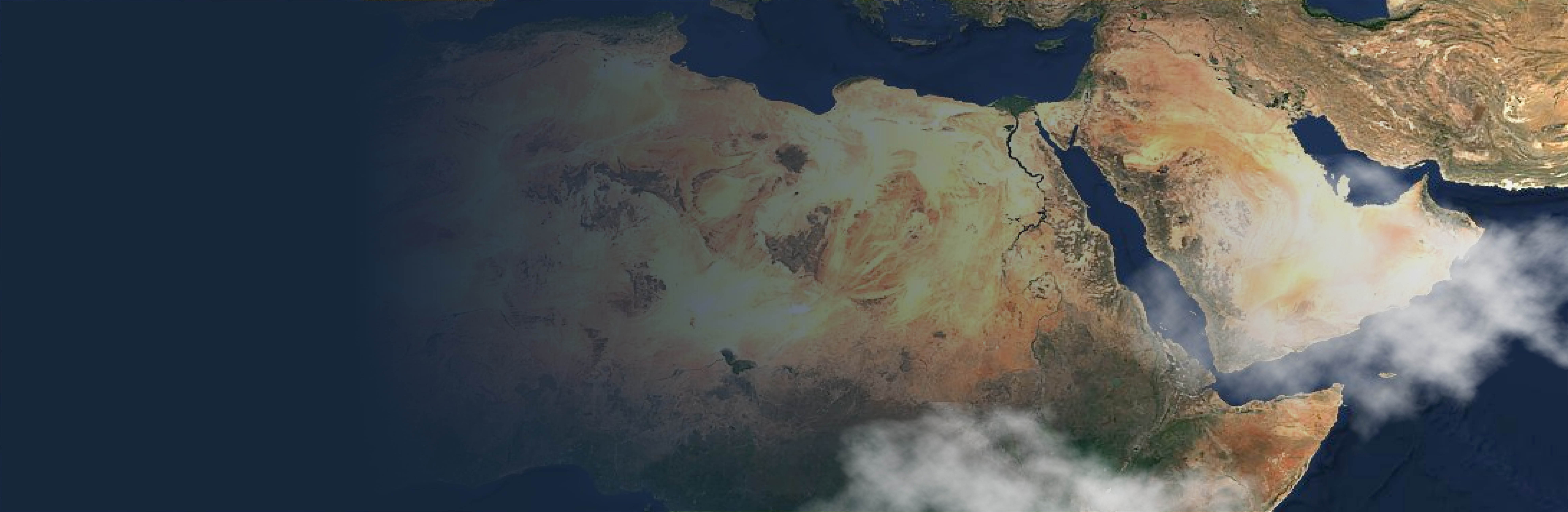
The North African region, due to its position in an arid zone, faces three major challenges: aridity, recurrent drought and desertification.
The countries of the region have undertaken ambitious policies and programmes aimed at sustainable management of natural resources. While substantial progress was made, much action remains to be done, particularly in the management and the optimization in the use of these resources.
Earth Observation (EO) contributes to a cost-effective decision-making process by making accessible reliable and timely information. The constellation of EO satellites allows free provision of satellite images, providing a good factor of sustainability.
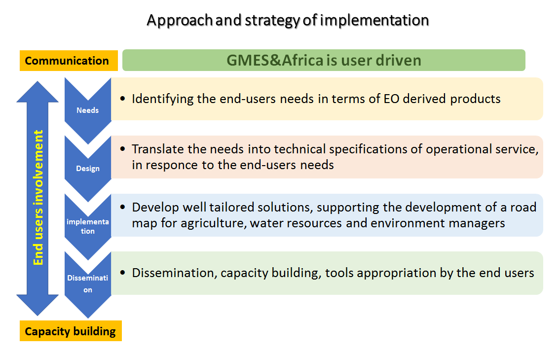
The integration of EO data and technologies in decision-making and the adoption of co-design approach can respond with relevance to the overall needs of North African countries in terms of natural resource management. The main strategies, which may help reaching this, can be summarized in the following points:
- Development of tools and models from EO data for the production of added-value information.
- Capacity building and advocacy for ownership of these tools, applications and products.
- Inter-country and inter-institutional cooperation and synergies to better manage common resources.
The approach and interventions of the North African GMES& Africa consortium in the implementation of the GMES&Africa initiative has succeeded in better unfolding these strategies, leading to provision of operational and integrated set of products and tools useful for sustainable land and water management in North Africa regions.